
Xinjiang Northern Xinjiang + Kanas Scenic Area + Hemu Scenic Area + Sayram Lake 7-Day 6-Night Route
★ **[Three Lakes Tour]** Heavenly Pool of Tianshan + Sayram Lake + Kanas Lake; “God’s Own Land” Hemu Village, the miraculously crafted Dushanzi Grand Canyon, and the internet-famous Colorful Beach. 【[Internet-Famous Scenic Highway]** S21 Desert Scenic Expressway, touring the beautiful scenery of the Gurbantünggüt Desert.
Note:
- Choose the season around the places you want to see. Autumn colours and winter snow offer different experiences, but winter roads, shuttle systems and accommodation can be restricted or disrupted. Check current local conditions rather than treating the full seven-day circuit as a routine winter drive.[5]

Itinerary
Day 1 — Arrive in Urumqi
Full itinerary heading
Day 01 — Arrive in Urumqi (independent sightseeing options in the city area, explore the flavors of the northwest)
Upon arriving in Urumqi,
Indulge in the long-awaited Western Region cuisine that everyone craves when they come to Xinjiang. Urumqi is the heart of Xinjiang’s cuisine, where you can taste authentic and delicious dishes such as barbecue (mutton skewers), roasted whole lamb, pilaf, hand-pulled noodles, naren, horse sausage, blood sausage, and noodle lung soup. Hurry up and start a feast for your taste buds!
Some recommended Urumqi foods:
1. Wenzhou Street Food Street: New-style fusion restaurants, revolving hot pot, Xin Ding Meatball Soup, air-dried meat pilaf restaurant, salmon head, etc.
2. Xingfu Road Food Street: Shawan Big Plate Chicken, Ma Shi Jiu Bao, Ma’s Braised Goose, etc.
3. Altay Road Food Circle: Blood Station Big Plate Chicken, Gu Bo Pen Pen Meat, Grain Insect Chicken, etc.
4. Changsha Road Pilaf Street: A variety of characteristic pilaf restaurants.
Day 2 — Heavenly Lake, the S21 Highway & Burqin
Original itinerary heading
Day 02 — Urumqi --- Heavenly Lake (Tianchi) --- S21 Desert Scenic Highway --- Burqin
Tianchi (Chinese: 天池; pinyin: Tiānchí, Uyghur: بوغدا كۆلى) is an alpine lake in Xinjiang, Northwest China. The name (天池) literally means Heavenly Lake and can refer to several lakes in mainland China and Taiwan. This Tianchi lies on the north side of the Bogda Shan (“Mountain of God”, Bogda is a Mongolian word meaning “God”) range of the Tian Shan (“Mountain of Heaven”), about 30 kilometres (19 mi) south of Fukang and 45 kilometres (28 mi) east (straight-line distance) of Ürümqi. It is an alpine drift lake shaped in the Quaternary Glacier period. Planning note: Tianchi sightseeing plus the long drive to Burqin is very demanding. Separate the lake day from the northbound transfer or omit it; allow daylight driving and confirmed overnight accommodation.
Day 3 — Kanas Observatory, Three Bays & Hemu
Original itinerary heading
Day 03 — Burqin --- Kanas Observatory Platform --- Kanas Three Bays --- Hemu Scenic Area
Kanas Lake (Chinese: 喀纳斯湖; pinyin: Kānàsī Hú, Xiao’erjing: كَانَاسِ خٗ; Mongolian: Ханас нуур; Uyghur: قاناس كۆلى, USY: Қанас Көли) is a lake in Altay Prefecture, Xinjiang, China. The lake is located in a valley in the Altai Mountains, near the very northern tip of Xinjiang and the autonomous region’s borders with Russia, Kazakhstan and Mongolia. The lake was formed around 200,000 years ago during the Quaternary period as a result of glacier movement. The crescent moon shaped lake has an estimated water storage capacity of 53.8 billion cubic meters, coupled with an average depth of around 120 meters. Planning note: Kanas and Hemu have their own access/shuttle arrangements. Do not assume the viewpoint, all three bays and the onward transfer are achievable in one day; add a Kanas-area night if needed.
The Kanas River, flowing out of the lake, later merges with the Hemu River to form the Burqin River, which itself discharges into the Irtysh River at Burqin Town, the county seat of Burqin County.
There is a large population of ethnic Tuvans and Kazakhs in the Kanas valley. While most of these people have maintained their traditional agricultural and nomadic life styles, many work in the developing tourism industry and have established facilities for orienteering, hiking, rafting, rock climbing, paragliding and camping. The scenic spot is classified as a AAAAA scenic area by the China National Tourism Administration.
Day 4 — Hemu sunrise, Wucai Beach & Wuerhe
Original itinerary heading
Day 04 — Watch the sunrise in Hemu, free time in Hemu Scenic Area --- Wucai Beach --- Wuerhe Town/Karamay City
Hemu Village (Tuvan: Ком, Oirat: ᠬᠣᠮ, Kazakh: قوم) is located in the northern part of Xinjiang Uyghur Autonomous Region of China, bordering Kazakhstan to the northwest and is about 70 kilometers away from the Kanas River. Administratively, it belongs to Hemu Kanas Mongolian Township, Burqin County, Altay Prefecture, Ili Kazakh Autonomous Prefecture. In 2005, it was selected as one of China’s most beautiful villages by the “Huaxia Geography” magazine. Planning note: Sunrise depends on weather, and the southbound move is substantial. Keep Wucai Beach optional and do not continue a long drive simply to tick off every stop.
The residents of Hemu Village are mainly Tuvan and Kazakh ethnic groups, who mainly rely on nomadic herding for their livelihood.
This place is one of the only three Tuvan villages remaining in China.
Day 5 — Sayram Lake & Kuitun or Bole
Original itinerary heading
Day 05 — Wuerhe Town —— Sayram Lake Scenic Area —— Kuitun/Bole City
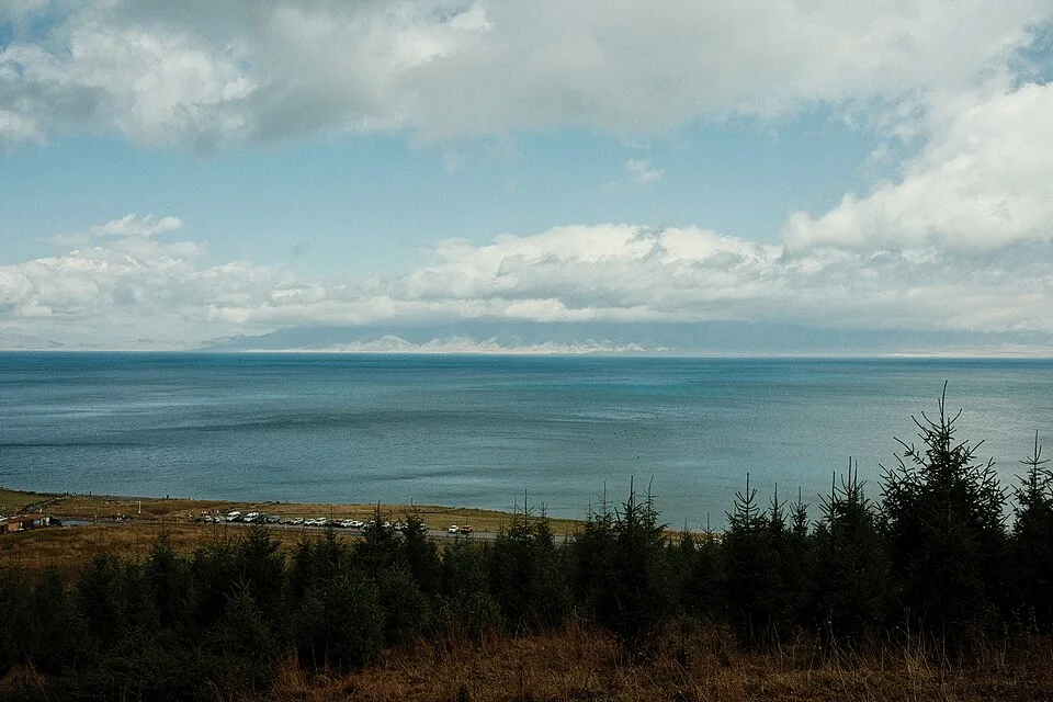
Sayram Lake (Chinese: 赛里木湖; pinyin: Sàilǐmù hú; Kazakh: Сайрам көлі, romanized: Sairam köli; Mongolian: Сайрам нуур, romanized: Sairam nurr), also known as Santai Haizi (Chinese: 三台海子) or historically the “Clean Sea” (净海), is an endorheic freshwater lake in the northern Tianshan Mountains at Börtala Mongol Autonomous Prefecture, Xinjiang, China, less than 50 km (31 mi) from the border with Kazakhstan. The name Sayram originally derives from Kazakh, meaning “blessing”. Planning note: Sayram Lake adds a long southwest detour from the Kanas/Hemu circuit. Give the transfer and lake visit separate days, or omit Sayram from a seven-day version. Choose Bole or Kuitun according to the real next-day route, not as interchangeable nearby bases.
The lake is the largest (458 km2 or 177 sq mi) and also the highest (at 2,070 m or 6,790 ft) alpine lake in Xinjiang, largely filled by glacial meltwater, residual precipitation from the Eurasian westerlies and runoffs from the surrounding mountain chains, as well as some groundwater springing and seepage. Check the current scenic-area visitor guidance for admission and vehicle rules.
Day 6 — Dushanzi Grand Canyon & Urumqi
Original itinerary heading
Day 06 — Bole/Kuitun —— Dushanzi Grand Canyon —— Urumqi
Known as the “Duku Secret Realm, a Wonder of a Billion Years,” the Dushanzi Grand Canyon is located in the Dushanzi District of Karamay City, Xinjiang. The Dushanzi Grand Canyon is situated at an altitude of 1070 meters and is characterized by its gorge landform. The width of the valley floor ranges from 100 to 400 meters, while the width of the valley shoulders is from 800 to 1000 meters. The height from the valley floor to the valley shoulders reaches up to 200 meters. It serves as the starting point of the Duku Highway, one of the most beautiful roads in China, and is also the first scenic spot on the Duku Highway.
The fame of Dushanzi in Xinjiang is not only due to this grand canyon but also because it is the birthplace of Xinjiang’s first oil well. In 1909, the local government of Xinjiang spent 300,000 taels of silver to purchase machinery from Russia and drilled Xinjiang’s first oil well in Dushanzi. The “Xinjiang Atlas” described it as “the well is 7 to 8 zhang deep (approximately 23 to 26 meters), with sounds inside like waves, and oil and gas are billowing and gushing out directly.” “When ignited, the flame is several feet high.” In May 2013, Xinjiang’s first oil well in Dushanzi was listed as a national key cultural relics protection unit.
Day 7 — Depart Urumqi
Original itinerary heading
Day 07 — Urumqi - Return Trip
Check Urumqi’s actual international and domestic services for your travel date. Do not assume a transfer through Chengdu or Xi’an is mandatory; choose the itinerary you can book and leave a disruption buffer.
FAQs
1. Q: What can you taste in Urumqi?
2. Q: What is Tianchi?
3. Q: What is Kanas Lake?
A: Kanas Lake is a lake in Altay Prefecture, Xinjiang. It was formed around 200,000 years ago during the Quaternary period as a result of glacier movement.
4. Q: Who are the residents of Hemu Village?
A: The residents are mainly Tuvan and Kazakh ethnic groups who rely on nomadic herding. It is one of the only three Tuvan villages remaining in China.
5. Q: What is Sayram Lake?
A: Sayram Lake is an endorheic freshwater lake in Xinjiang. The name originally derives from Kazakh, meaning “blessing”.
6. Q: What entry permission does this route require?[3]
A: Xinjiang is not in the current 240-hour transit permitted-area table. For 240-hour transit, eligibility depends on your passport, designated port, confirmed onward travel to a third country or region, and the stay granted. Verify the current NIA rules before booking; otherwise use another valid entry/stay basis.[4]
Before you make arrangements
Current Kanas/Hemu winter operating rules, roads, shuttle/vehicle access and foreign-document permissions remain unconfirmed for specific dates. Confirm border-area restrictions, available accommodation and Sayram Lake entry arrangements with authorities/operators before travel.
Notes & sources
These notes support the specific corrections above. They do not mean that every sentence, future opening time or individual eligibility has been verified.
Correction notes and source scope
Remove unsupported sale/group-departure implication while preserving destination names and original duration.
Editorial correction; no new factual-verification date claimed.Clarify that unstructured time does not mean attraction admission or purchases are free.
Editorial correction; no new factual-verification date claimed.Replace obsolete 144-hour FAQ with current entry-permission question.
NIA — current visa-free transit policy and permitted-area tableSource checked 2026-10-31Remove blanket 144-hour entitlement and obsolete 2024 guide reference; apply current NIA conditions and route-specific geographical limits.
NIA — current visa-free transit policy and permitted-area tableSource checked 2026-10-31Remove blanket autumn/winter recommendation; preserve seasonal appeal with explicit route constraints.
Xinjiang Transport Department — snow disruption evidenceSource checked 2026-10-29Keep original destination narrative; add specific pacing/access constraint for this day.
Editorial correction; no new factual-verification date claimed.Keep original destination narrative; add specific pacing/access constraint for this day.
Editorial correction; no new factual-verification date claimed.Keep original destination narrative; add specific pacing/access constraint for this day.
Editorial correction; no new factual-verification date claimed.Keep original destination narrative; add specific pacing/access constraint for this day.
Editorial correction; no new factual-verification date claimed.Remove false/unstable flight-network assertion.
Editorial correction; no new factual-verification date claimed.Remove outdated rating assertion; retain lake description.
Editorial correction; no new factual-verification date claimed.
- NIA — current visa-free transit policy and permitted-area table
31 route geographic-scope screenings; image table independently viewed locally. Reopened in this review.
Checked 2026-10-31 - Xinjiang Transport Department — snow disruption evidence
Historical evidence of prolonged snow disruption; NOT a present road closure notice. Evidence inherited from the 29 October audit; not a fresh operating-calendar check.
Checked 2026-10-29 - Government of Canada — China travel advice
Travel permits/approved travel arrangements in Tibet; verify with relevant authorities. Reopened in this review.
Checked 2026-10-31