
Lanzhou + Gannan + Zaga Na + Ruo'ergai + Lianbao Yezhi Scenic Area + A'wan Cang Wetland 7-Day 6-Night Route
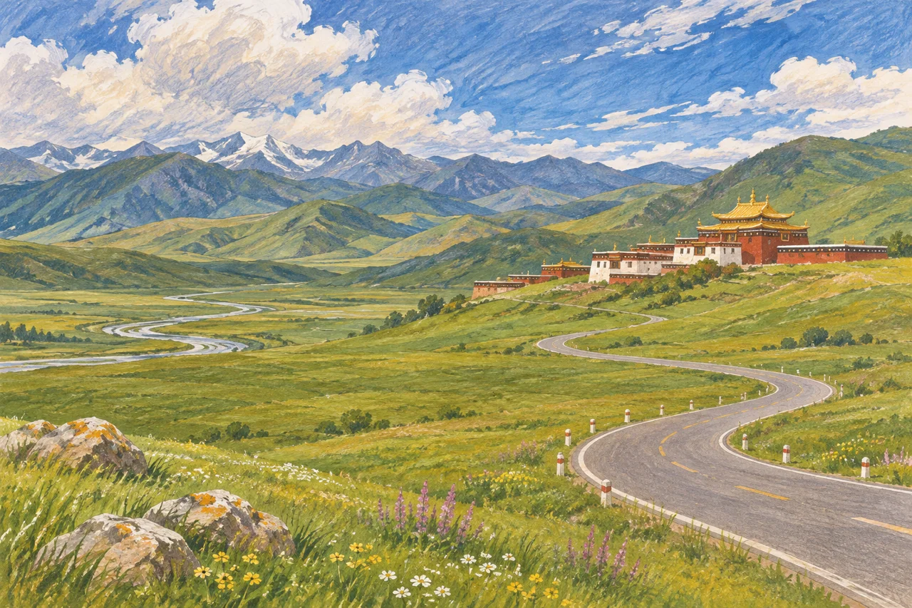
Gannan – Known as “China’s Little Tibet,” let your eyes be half for the scenery and half for the faith.
Note:
- High-altitude illness can affect any traveller. Build in gradual ascent, rest and alternatives; seek individual medical advice when relevant instead of treating this seven-day outline as a safe acclimatisation schedule.[5]
- Pack layers for rapid weather changes and cold high-elevation conditions. Snow and ice are seasonal and route-dependent, not a permanent condition across the entire itinerary.
Itinerary
Day 1 — Arrive in Lanzhou
Full itinerary heading
Day 01 — Various Places -- Lanzhou, Full Day independent sightseeing options [Gathering in Golden City Lanzhou]
City Attractions:
– **Zhongshan Iron Bridge** Dating from the early twentieth century, it is one of the oldest bridges in Lanzhou and is known as “The First Bridge over the Yellow River in the World.”
– **Sculpture of the Mother of the Yellow River** One of the many sculptures across the country that represent the Yellow River, the mother river of the Chinese nation, it has won the Excellence Award in the first national urban sculpture plan evaluation.
– **Yellow River Scenic Belt** An urban riverside green corridor that integrates mountains, waters, and cultural heritage.
– **Gansu Provincial Museum** It collects precious cultural relics from ancient times to modern in Gansu, with a collection of more than 80,000 pieces (sets) of precious historical cultural relics and natural specimens, especially characterized by Gansu painted pottery from the Neolithic Age, Han Dynasty bamboo slips, Han and Tang Dynasty Silk Road treasures, Buddhist art treasures, and ancient biological fossils. Check the museum’s current reservation calendar and closure days before visiting.
Specialty Dining:
– Lanzhou Beef Noodle Soup: Mogan Beef Noodle Soup, Bai Jianqiang Beef Noodle Soup, Jin Qiang Beef Noodle Soup, etc.
– Specialty Snacks: Grey Bean, Milk and Egg Fermented Rice, Sweet Fermented Dough, Stuffed Skin, Crystal Cake, Mutton Skewers, etc.
– Specialty Cuisine: Fat Mom’s Hand-Grabbed Meat, Ma Zhonghua Hand-Grabbed Meat, Zhengning Road Night Market, etc.
Day 2 — Luoke Road, Zaga Na & Diebu
Original itinerary heading
Day 02 — Lanzhou — Luoke Road — Zaga Na — Diebu (Elevation Note: The highest point on Luoke Road is approximately 4000 meters, Zaga Na is about 2800 meters, and Diebu is around 2400 meters).
Zaga Na, located in Diebu County, Gannan Tibetan Autonomous Prefecture, Gansu Province, China, is a village known for its beautiful scenery. Planning note: The Luoke road detour and arrival at Zaga Na depend on road status and your acclimatisation. Confirm foreign-visitor access locally and allow an extra travel/rest night rather than rush over high passes.[10]
In the summer of 1925, the great explorer Joseph Rock, who provided rare materials for Hilton’s creation of the Shangri-La landscape in “Lost Horizon” with his photos and articles published in the American “National Geographic” magazine, collected plants in Diebu. He wrote: “A temple called La Sang Temple is nestled against the mountain, beneath which lies the village of Diebu people, with houses adjacent to each other, and terraced fields of wheat and barley. Behind all these are the huge limestone mountains, with lush spruce and fir covering the canyons and slopes.”
As the first Westerner to explore the Gannan region and the first to collect plant and animal specimens and draw maps in Diebu, Zaga Na undoubtedly left a deep impression on him. He recorded his paradise in his diary: “I have never seen such a magnificent scenery in my life. If the author of ‘Genesis’ had seen the beautiful scenery of Diebu, he would place the birthplace of Adam and Eve here. The place of Diebu shocked me, the vast forest is a botanical museum, it is absolutely a virgin land. It will become a paradise for people who love nature and all tourists.”
Day 3 — Huahu Lake, the Yellow River’s First Bend & Tangke
Original itinerary heading
Day 03 — Diebu — Huahu Lake — The First Bend of the Yellow River — Tangke (Elevation Note: Huahu Lake is approximately 3600 meters, Tangke is about 3400 meters).
The Yellow River meets the Baihe River in Tangke Township, Ruo’ergai County, Sichuan, forming the magnificent first bay of the Nine-Turns of the Yellow River. This place offers a view of a unique and magnificent natural landscape and is also a favorite spot for photographers. To enjoy the view of the first bay of the Nine-Turns of the Yellow River, you can climb the stairs or take an elevator to reach the viewing platform. The scenery from the viewing platform will make you forget all your worries, and it is also an excellent place to watch the sunset. The meandering Yellow River is particularly enchanting in the glow of the setting sun, as if “the rosy clouds and the wild ducks fly together, and the autumn water shares the same color with the sky.” Planning note: Huahu and Tangke are high plateau stops. Use open boardwalks and confirm weather/access; sunset viewing is optional, with a safe daylight-transfer plan where possible.
Day 4 — Ruo’ergai Grassland, Lianbao Yezhi & Aba
Original itinerary heading
Day 04 — Tangke — Hongyuan — Ruo'ergai Grassland — Lianbao Yezhi — Aba (Elevation Note: Lianbao Yezhi is approximately 4200 meters, Aba is about 3300 meters).
Lianbao Yeze (Lianbao Yezhi), also known as Stone Mountain (Tibetan name: Ye’er Jing Zhala) , is located in the southeastern part of the Qinghai-Tibet Plateau , between Aba County in the Aba Tibetan and Qiang Autonomous Prefecture of Sichuan Province and Jiuzhi County and Banma County in Qinghai Province, covering an area of about more than 800 square kilometers, with an area of more than 500 square kilometers within the territory of Aba, Sichuan[6], and is called Nianbao Yuze in Qinghai, also known as Golog Mountain. Planning note: Lianbao Yezhi is a substantial high-altitude detour. It is optional, not a compulsory checkpoint; omit it if access, weather, health or daylight driving would make the day unsuitable.[12]
Lianbao Yezhi Mountain is a majestic branch of the Golog Mountain range of the Bayan Har Mountains on the Qinghai-Tibet Plateau, with an altitude ranging from 3500 meters to 5369 meters, and the highest peak at 5369 meters, which is snow-capped all year round. It is a famous sacred mountain in the Tibetan area, ranking eighth among the top ten sacred mountains in the Tibetan region and is the foremost among the sacred mountains of the Amdo region. [10] It is also called Ye’er Jing Zhala, and its Tibetan meaning is the dignified jade peak, which is a sacred mountain sacred to the local Tibetan people.
Day 5 — Nyangma Temple, A’wan Cang Wetland & Hezuo
Original itinerary heading
Day 05 — Aba — Nyangma Temple — A'wan Cang Wetland — Hezuo (Elevation Note: A'wan Cang Wetland is approximately 3600 meters, Hezuo is about 3000 meters).
The remote Awancang grassland is located in the southern part of Maqu County, Gansu Province, in the crook of the Yellow River. The grassland is 50 kilometers away from the county town of Maqu. The Yellow River flows from west to east from Jiuzhi, Qinghai, into theMUXI of Maqu. Due to poor water discharge, many tributaries and marshes are formed, making this vast grassland lush with water and grass, and the cattle and sheep are plump and strong. Its remoteness makes transport, accommodation and local visitor access important advance checks.
The Awancang Scenic Area to be visited includes the Awancang grassland, Gongsaer Kamado, and Awancang Monastery. Under the azure sky, the boundless green grassland stretches as far as the eye can see, with white flocks of sheep and black herds of yaks, dotted and leisurely; the streams on the grassland meander and crisscross, and the marshes are scattered like stars, shimmering in the sunlight, a feast for the eyes; from time to time, there are heavenly pastoral songs drifting from afar, in authentic Tibetan, primitive and simple; everything is so quiet and harmonious, with continuous paintings everywhere, here is nothing but nature, it has always been like this for thousands of years, through the rise and fall of history, the Awancang grassland remains, far away from the hustle and bustle of the city, with wide open landscapes and a quieter pace than the cities.
Day 6 — Labrang Monastery, Ganja & Lanzhou
Original itinerary heading
Day 06 — Hezuo — Crossing the Sangke Grassland — Labrang Monastery — Ganja Secret Realm — Lanzhou (Elevation Note: Labrang Monastery is approximately 3200 meters, Ganja Secret Realm is about 3500 meters).
Labrang Monastery (Tibetan: བླ་བྲང་བཀྲ་ཤིས་འཁྱིལ་, Wylie: bla-brang bkra-shis-‘khyil; Chinese: Lābǔléng Sì, 拉卜楞寺) is one of the six great monasteries of the Gelug school of Tibetan Buddhism. Its formal name is Genden Shédrup Dargyé Trashi Gyésu khyilwé Ling (Tibetan: དགེ་ལྡན་བཤད་སྒྲུབ་དར་རྒྱས་བཀྲ་ཤིས་གྱས་སུ་འཁྱིལ་བའི་གླིང༌།, Wylie: dge ldan bshad sgrub dar rgyas bkra shis gyas su ‘khyil ba’i gling). Planning note: Labrang, Ganja and the return to Lanzhou compete for time. Choose the monastery or the additional Ganja excursion and add a night rather than guarantee both before a long return drive.
Labrang is located in Xiahe County, Gannan Tibetan Autonomous Prefecture, Gansu, in the traditional Tibetan area of Amdo. Labrang Monastery is home to the largest number of monks outside the Tibet Autonomous Region. Xiahe is about four hours by car from the provincial capital Lanzhou.
In the early part of the 20th century, Labrang was by far the largest and most influential monastery in Amdo. It is located on the Daxia River, a tributary of the Yellow River.
Day 7 — Depart Lanzhou
Original itinerary heading
Day 07 — Lanzhou -- Various Places [Farewell to the Northwest]
Check Lanzhou’s flight and rail options for your travel date. Use the connection that is actually available; this guide does not assume international services are absent.
FAQs
1. Q: What is the significance of Zhongshan Iron Bridge?
A: Dating from the early twentieth century, Zhongshan Iron Bridge is one of the oldest bridges in Lanzhou and is known as “The First Bridge over the Yellow River in the World.”
2. Q: What can I see at the Gansu Provincial Museum?
3. Q: Where is Zaga Na located and what is it famous for?
4. Q: How can I best enjoy the view of the first bay of the Nine-Turns of the Yellow River?
A: You can climb the stairs or take an elevator to reach the viewing platform for a panoramic view. It’s also a great place to watch the sunset.
5. Q: What can I experience at the Awancang grassland?
A: At Awancang grassland, you can see vast green grassland, white flocks of sheep and black herds of yaks, meandering streams, marshes, and enjoy heavenly pastoral songs. It is a beautiful grassland far away from the hustle and bustle of the city.
6. Q: What entry permission does this route require?[3]
A: Gansu and the northern Sichuan plateau stops in this route are outside the current 240-hour permitted areas. For 240-hour transit, eligibility depends on your passport, designated port, confirmed onward travel to a third country or region, and the stay granted. Verify the current NIA rules before booking; otherwise use another valid entry/stay basis.[4]
Before you make arrangements
Current opening and foreign-visitor access for Zaga Na, Huahu, Lianbao Yezhi and the selected roads have not been independently confirmed. Obtain a realistic driver itinerary with overnight bases, daylight driving and cancellation alternatives.
Notes & sources
These notes support the specific corrections above. They do not mean that every sentence, future opening time or individual eligibility has been verified.
Correction notes and source scope
Remove unsupported sale/group-departure implication while preserving destination names and original duration.
Editorial correction; no new factual-verification date claimed.Clarify that unstructured time does not mean attraction admission or purchases are free.
Editorial correction; no new factual-verification date claimed.Replace obsolete 144-hour FAQ with current entry-permission question.
NIA — current visa-free transit policy and permitted-area tableSource checked 2026-10-31Remove blanket 144-hour entitlement and obsolete 2024 guide reference; apply current NIA conditions and route-specific geographical limits.
NIA — current visa-free transit policy and permitted-area tableSource checked 2026-10-31Replace weak-cardiopulmonary-only warning with general altitude planning.
CDC Yellow Book 2026 — high-altitude travelSource checked 2026-10-31Correct overbroad perennial snow/weather assertion.
Editorial correction; no new factual-verification date claimed.Remove unsupported bridge completion year; retain historical landmark description.
Editorial correction; no new factual-verification date claimed.Remove unsupported bridge completion year; retain historical landmark description.
Editorial correction; no new factual-verification date claimed.Remove unverified one-day reservation deadline; retain collection details.
Editorial correction; no new factual-verification date claimed.Keep original destination narrative; add specific pacing/access constraint for this day.
CDC Yellow Book 2026 — high-altitude travel Government of Canada — China travel adviceSource checked 2026-10-31Keep original destination narrative; add specific pacing/access constraint for this day.
Editorial correction; no new factual-verification date claimed.Keep original destination narrative; add specific pacing/access constraint for this day.
CDC Yellow Book 2026 — high-altitude travelSource checked 2026-10-31Remove romanticised claim that a tourist destination is closed to the outside world.
Editorial correction; no new factual-verification date claimed.Remove unsupported pollution-free claim.
Editorial correction; no new factual-verification date claimed.Keep original destination narrative; add specific pacing/access constraint for this day.
Editorial correction; no new factual-verification date claimed.Remove unsupported current airline-network assertion.
Editorial correction; no new factual-verification date claimed.
- NIA — current visa-free transit policy and permitted-area table
31 route geographic-scope screenings; image table independently viewed locally. Reopened in this review.
Checked 2026-10-31 - CDC Yellow Book 2026 — high-altitude travel
Gradual ascent, acclimatization and individual medical planning; no herbal preventive recommendation. Reopened in this review.
Checked 2026-10-31 - Government of Canada — China travel advice
Travel permits/approved travel arrangements in Tibet; verify with relevant authorities. Reopened in this review.
Checked 2026-10-31